[History] 5. 지도를 거꾸로 본 이슬람 학자: 콜럼버스보다 350년 먼저 신대륙을 그린 남자 (The Islamic Scholar Who Reversed the Map: The Man Who Sketched the New World 350 Years Before Columbus)
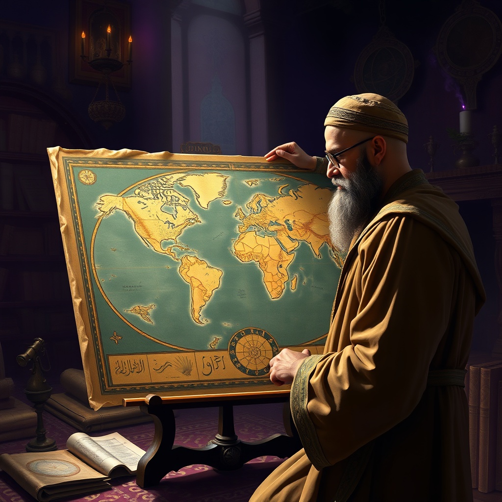
아메리카 대륙을 '발견'한 사람이 누구냐고 묻는다면, 대부분은 주저 없이 크리스토퍼 콜럼버스를 외칠 겁니다. 🌍 하지만 만약, 그보다 350년도 더 전에 이미 미지의 대륙 존재 가능성을 암시했던 인물이 있었다면 어떨까요? 그것도 서양의 주류 학계가 아닌, 동양의 한 이슬람 문명권에서 말이죠. 🤔 오늘 '역사의 조연들'에서 소개할 주인공은 바로 중세 이슬람의 가장 위대한 지리학자 중 한 명인 알 이드리시(Al-Idrisi)입니다. 그의 지도가 가진 '숨겨진 비밀'을 파헤쳐 볼까요?
지식의 황금기, 이슬람 문명의 빛 📜
서유럽이 '암흑 시대'라 불리던 중세 시대, 이슬람 문명은 지식과 문화의 황금기를 구가하고 있었습니다. 바그다드, 카이로, 코르도바 같은 도시들은 세계 각지의 학자들이 모여 지식을 교환하고 발전시키는 대규모 도서관과 학술 기관의 중심지였죠. 그리스-로마 시대의 고전 지식은 물론, 인도와 중국의 지혜까지 아랍어로 번역되고 연구되며 새로운 발견과 발명으로 이어졌습니다. 특히 지리학과 천문학은 이 시기 이슬람 학자들의 주된 관심사였습니다. 실크로드를 통한 광범위한 교역과 순례는 정확한 지도와 항해술의 필요성을 증대시켰고, 이는 곧 과학적 탐구로 이어졌습니다. 알 이드리시는 바로 이런 풍요로운 지적 토양 위에서 자라난 인물이었습니다.
알 이드리시 (Abu Abdullah Muhammad al-Idrisi) 🗺️
- 생몰년: 1100년 경 ~ 1165년 경
- 국적/활동지: 모로코(세우타) 출생, 주로 시칠리아에서 활동
- 주요 업적: '로제르의 책' (Nuzhat al-Mushtaq fi Ikhtiraq al-Afaq), '타불라 로제리아나' 지도 제작
- 특징: 중세 이슬람의 가장 위대한 지리학자 중 한 명, 동서양 지식을 통합하여 세계 지도 제작
시칠리아 왕궁으로 간 이슬람 학자 🌍
알 이드리시는 북아프리카의 세우타(현재 스페인 영토)에서 태어나 스페인 코르도바에서 교육을 받았습니다. 그는 여러 지역을 여행하며 방대한 지식을 쌓았고, 그 명성이 이탈리아 남부의 시칠리아 왕국에까지 이르렀습니다. 당시 시칠리아는 노르만 왕 로제르 2세가 통치하고 있었는데, 그는 종교적 배경을 뛰어넘어 지식과 문화에 대한 깊은 이해를 가진 군주였습니다. 로제르 2세는 알 이드리시를 자신의 궁정으로 초대했고, 그에게 인류 역사상 가장 위대한 지리서와 지도를 만들어 달라는 전례 없는 프로젝트를 맡겼습니다. 이는 당시 유럽에서는 찾아볼 수 없는 놀라운 문화적 융합의 상징이었습니다. 기독교 군주와 이슬람 학자의 만남이라니, 마치 한 편의 영화 같지 않나요?
세계를 담아내다: '로제르의 책'의 탄생 ✨
알 이드리시는 로제르 2세의 지원 아래 약 15년에 걸쳐 이 대규모 프로젝트에 몰두했습니다. 그는 수많은 여행가, 상인, 학자들을 불러 모아 전 세계의 지리 정보를 수집했습니다. 이 과정에서 직접 확인된 정보뿐만 아니라, 기존 문헌과 구전 설화까지 꼼꼼히 교차 검증하는 당대 최고의 과학적 방법론을 사용했습니다. 이렇게 집대성된 정보는 1154년에 '로제르의 책'(Nuzhat al-Mushtaq fi Ikhtiraq al-Afaq, '세계를 탐험하고 싶어 하는 사람의 즐거움')이라는 제목의 방대한 지리서와 함께 '타불라 로제리아나'(Tabula Rogeriana)라는 이름의 거대한 은제 세계 지도로 탄생했습니다. 이 지도는 당시 알려진 세계를 완벽하게 담아낸 걸작이었습니다. 무게가 무려 400kg에 달했다는 기록도 전해지죠. 상상만 해도 정말 대단하지 않습니까?
지도를 거꾸로 뒤집은 파격 🗺️💥
알 이드리시의 지도가 특별한 이유는 단순히 정교함 때문만이 아니었습니다. 그가 제작한 '타불라 로제리아나'는 당시의 모든 상식을 뒤엎는 파격적인 특징을 가지고 있었는데, 바로 남쪽을 지도의 '위'에 두었다는 점입니다. 현대 지도와 달리 위쪽이 남쪽, 아래쪽이 북쪽으로 그려져 있었죠. 오늘날 우리는 북쪽이 위인 지도에 익숙하지만, 고대와 중세에는 동쪽이 위인 지도가 많았고, 이슬람권에서는 남쪽이 위인 지도가 종종 발견되기도 했습니다. 하지만 알 이드리시의 지도는 단순히 방향의 문제가 아니었습니다.
이 지도를 자세히 들여다보면, 아프리카 대륙의 서쪽과 유럽 대륙의 서쪽 너머, 즉 '어둠의 바다'로 알려진 대서양 건너편에 미지의 거대한 육지 덩어리가 그려져 있었습니다. 비록 명확하게 아메리카 대륙의 형태를 띠지는 않았지만, 당시 어떤 지도에서도 찾아볼 수 없었던 서쪽 끝의 육지 표현은 이후 콜럼버스가 도달하게 될 신대륙의 존재를 무려 350년이나 먼저 '암시'한 통찰로 해석될 수 있습니다. 과연 그는 어떻게 이처럼 시대를 초월한 지리적 상상을 할 수 있었을까요? 그의 지도에는 동서양의 지식이 총망라되어 있었고, 어쩌면 그 과정에서 아틀란티스 전설처럼 구전으로 전해지던 '서쪽의 땅'에 대한 단편적인 정보가 반영되었을 수도 있습니다.
일부 학자들은 알 이드리시의 지도에 그려진 서쪽의 육지가 아메리카 대륙을 명확히 지칭한다고 보기 어렵다고 주장하기도 합니다. 이는 당시의 지리학적 한계와 상상력이 결합된 결과일 수 있으며, 실제 대륙의 발견과는 다른 맥락에서 해석해야 한다는 것이죠. 하지만 그의 지도가 보여준 당대 최고의 지리적 지식과 과감한 통찰은 여전히 높이 평가받고 있습니다.
숨겨진 진실, 그리고 그 이후 🔍
알 이드리시의 지도는 이슬람 문명권 내에서는 중요한 유산으로 여겨졌지만, 안타깝게도 서유럽에는 널리 전파되지 못했습니다. 당시 유럽은 여전히 프톨레마이오스의 지리학적 모델에 크게 의존하고 있었고, 이슬람 세계의 발전된 지식은 종교적, 문화적 장벽으로 인해 제대로 받아들여지지 못하는 경우가 많았습니다. 만약 알 이드리시의 지도가 콜럼버스 시대에 서유럽 학자들에게 더 널리 알려지고 연구되었다면, 대항해 시대의 역사가 조금은 달라졌을지도 모릅니다. 그의 지도는 그 자체로 하나의 독립적인 발견이자, 인류가 세계를 이해하려는 노력에 있어 중요한 이정표가 됩니다.
역사의 물줄기를 바꾼 통찰의 의미 💡
알 이드리시의 이야기는 우리가 아는 역사가 항상 한 방향으로만 흘러가지 않으며, 숨겨진 곳에 놀라운 발견과 통찰이 존재했음을 일깨워줍니다. 그의 지도는 단순한 그림이 아니라, 당시의 고정관념을 깨고 새로운 가능성을 제시한 위대한 통찰의 산물입니다. 지식의 경계를 허물고 미지의 세계를 탐구하려는 인간의 끊임없는 열망을 보여주는 증거이기도 합니다. 그의 시대를 앞서간 발상 덕분에 우리는 역사가 결코 단선적이지 않다는 사실을 다시금 깨닫게 됩니다.
자주 묻는 질문 (FAQ) 🤔
-
Q: 알 이드리시의 지도가 왜 콜럼버스에게 알려지지 않았나요?
A: 당시 유럽과 이슬람 문명권 간의 교류는 활발했지만, 지리적 지식, 특히 상세한 지도 정보의 직접적인 전파에는 한계가 있었습니다. 알 이드리시의 원본 지도는 은으로 만들어져 유실되었고, 필사본들은 대부분 이슬람 학술 공동체 내에서 유통되었으며, 라틴어로 번역된 것은 드물었습니다. 또한, 중세 유럽의 지리적 인식은 여전히 프톨레마이오스 체계에 크게 의존하고 있었죠. -
Q: 알 이드리시의 지도에 아메리카 대륙이 명확하게 그려져 있나요?
A: 아쉽게도 현대 지도의 아메리카 대륙처럼 명확한 형태로 그려져 있지는 않습니다. 하지만 당시의 모든 지식으로는 설명하기 어려운, 대서양 너머 서쪽에 거대한 육지 덩어리가 묘사되어 있습니다. 이는 단순한 상상이라기보다는, 당시 이슬람 탐험가들이 대서양을 건너 미지의 땅에 도달했다는 단편적인 정보들이 축적되어 반영된 결과일 가능성이 제기됩니다.
어떤가요, 콜럼버스보다 350년이나 앞서 미지의 대륙을 '상상'했던 알 이드리시의 이야기는? 그의 지도는 단순한 그림이 아니라, 당시의 고정관념을 깨고 새로운 가능성을 제시한 위대한 통찰의 산물입니다. 그의 시대를 앞서간 발상 덕분에 우리는 역사가 결코 한 방향으로만 흘러가지 않는다는 사실을 다시금 깨닫게 됩니다. 여러분이 알고 있는 또 다른 '역사의 조연'이 있다면 댓글로 알려주세요! 😊 다음 '역사의 조연들'에서는 또 어떤 숨겨진 이야기가 우리를 기다리고 있을까요? 기대해주세요!
The Islamic Scholar Who Reversed the Map: The Man Who Sketched the New World 350 Years Before Columbus
If you were to ask who 'discovered' the Americas, most would unhesitatingly exclaim Christopher Columbus. 🌍 But what if there was a figure who, more than 350 years earlier, had already hinted at the possibility of an unknown continent? And this, not from the mainstream Western academia, but from an Islamic civilization in the East. 🤔 Today, in 'Unsung Heroes of History,' we introduce Al-Idrisi, one of the greatest geographers of the medieval Islamic world. Shall we unravel the 'hidden secret' of his map?
The Golden Age of Knowledge, The Light of Islamic Civilization 📜
While Western Europe was in its 'Dark Ages,' Islamic civilization was experiencing a golden age of knowledge and culture. Cities like Baghdad, Cairo, and Cordoba were centers of vast libraries and academic institutions where scholars from around the world gathered to exchange and advance knowledge. Ancient Greek-Roman knowledge, as well as wisdom from India and China, was translated into Arabic and studied, leading to new discoveries and inventions. Geography and astronomy, in particular, were major interests of Islamic scholars during this period. Extensive trade and pilgrimages along the Silk Road increased the need for accurate maps and navigation skills, leading to scientific inquiry. Al-Idrisi was a figure who grew up in this rich intellectual environment.
Al-Idrisi (Abu Abdullah Muhammad al-Idrisi) 🗺️
- Born: Circa 1100 ~ Died: Circa 1165
- Nationality/Activity: Born in Ceuta (Morocco), active mainly in Sicily
- Major Works: 'Tabula Rogeriana' (Roger's Book), 'Nuzhat al-Mushtaq fi Ikhtiraq al-Afaq' (The Pleasure of One Who Yearns to Traverse the World)
- Characteristic: One of the greatest geographers of the medieval Islamic world, integrated Eastern and Western knowledge to create world maps
The Islamic Scholar Who Went to the Sicilian Royal Court 🌍
Al-Idrisi was born in Ceuta (now a Spanish enclave in North Africa) and educated in Cordoba, Spain. He traveled extensively, accumulating vast knowledge, and his reputation reached the Kingdom of Sicily in southern Italy. At that time, Sicily was ruled by the Norman King Roger II, a monarch with a deep appreciation for knowledge and culture, transcending religious backgrounds. Roger II invited Al-Idrisi to his court and entrusted him with an unprecedented project: to create the greatest geographical treatise and map in human history. This was a remarkable symbol of cultural fusion, something unheard of in Europe at the time. A meeting between a Christian king and an Islamic scholar—doesn't it sound like a movie?
Encompassing the World: The Birth of 'Roger's Book' ✨
With Roger II's support, Al-Idrisi dedicated approximately 15 years to this massive project. He gathered countless travelers, merchants, and scholars to collect geographical information from all over the world. In this process, he used the finest scientific methodologies of the era, meticulously cross-referencing information not only from direct observations but also from existing texts and oral traditions. The compiled information culminated in 1154 with a comprehensive geographical treatise titled 'Roger's Book' (Nuzhat al-Mushtaq fi Ikhtiraq al-Afaq, 'The Pleasure of One Who Yearns to Traverse the World') and a magnificent silver world map known as 'Tabula Rogeriana.' This map was a masterpiece that perfectly depicted the known world at the time. Records even suggest it weighed a remarkable 400 kg. Isn't it truly astonishing to imagine?
The Bold Move of Reversing the Map 🗺️💥
Al-Idrisi's map was special not only for its precision. The 'Tabula Rogeriana' he created featured a radical characteristic that defied all conventions of the time: he placed south at the 'top' of the map. Unlike modern maps, the top showed south, and the bottom showed north. Today, we are accustomed to maps with north at the top, but in ancient and medieval times, maps often had east at the top, and in the Islamic world, maps with south at the top were sometimes found. However, Al-Idrisi's map was not merely a matter of orientation.
If you look closely at this map, beyond the western part of Africa and Europe, across the Atlantic Ocean, known as the 'Sea of Darkness,' a large, unknown landmass was depicted. Although it did not clearly resemble the Americas, the portrayal of land at the western edge, unseen in any other map of the time, can be interpreted as an insight that 'hinted' at the existence of the New World a remarkable 350 years earlier than Columbus's arrival. How could he have made such a geographically advanced imagination? His map integrated knowledge from both East and West, and perhaps fragmented information about 'lands to the west,' passed down through oral tradition like the legend of Atlantis, was incorporated.
Some scholars argue that the land depicted in the western part of Al-Idrisi's map cannot be definitively identified as the Americas. They suggest it might be a result of combining the geographical limitations and imagination of the time, and should be interpreted in a different context than actual continental discovery. However, his map is still highly regarded for showcasing the best geographical knowledge and bold insight of its era.
The Hidden Truth, and What Followed 🔍
Al-Idrisi's map was considered an important legacy within the Islamic civilization, but unfortunately, it did not widely circulate in Western Europe. At that time, Europe still heavily relied on Ptolemy's geographical model, and advanced knowledge from the Islamic world was often not properly adopted due to religious and cultural barriers. If Al-Idrisi's map had been more widely known and studied by Western European scholars during Columbus's era, the history of the Age of Discovery might have been slightly different. His map stands as an independent discovery in itself and an important milestone in humanity's endeavor to understand the world.
The Meaning of Insight That Changed the Course of History 💡
Al-Idrisi's story reminds us that the history we know does not always flow in one direction, and that astonishing discoveries and insights have existed in hidden places. His map is not merely a drawing, but the product of a great insight that broke through the conventions of his time and suggested new possibilities. It is also evidence of humanity's relentless desire to break down the boundaries of knowledge and explore the unknown world. Thanks to his ahead-of-his-time thinking, we are once again reminded that history is never linear.
Frequently Asked Questions (FAQ) 🤔
-
Q: Why wasn't Al-Idrisi's map known to Columbus?
A: While there was active exchange between European and Islamic civilizations at the time, there were limitations in the direct dissemination of geographical knowledge, especially detailed map information. Al-Idrisi's original map, made of silver, was lost, and its copies primarily circulated within Islamic scholarly communities. Few were translated into Latin. Furthermore, medieval European geographical understanding largely relied on the Ptolemaic system. -
Q: Does Al-Idrisi's map clearly depict the Americas?
A: Unfortunately, it does not depict the Americas in a clear, modern map-like form. However, it does portray a large landmass to the west beyond the Atlantic Ocean, which was unexplainable with all the knowledge available at the time. It is suggested that this might not be mere imagination, but rather a reflection of fragmented information accumulated from Islamic explorers who may have reached unknown lands across the Atlantic.
So, what do you think of Al-Idrisi's story, who 'imagined' an unknown continent 350 years before Columbus? His map is not merely a drawing, but the product of a great insight that broke through the conventions of his time and suggested new possibilities. Thanks to his ahead-of-his-time thinking, we are once again reminded that history is never linear. If you know of another 'unsung hero of history,' please share it in the comments! 😊 What hidden story awaits us in the next 'Unsung Heroes of History'? Stay tuned!
댓글
댓글 쓰기